

Round hike in Glomsdalen

If your fitness is reasonably good, and you have experience of walking in slightly rough terrain, you will enjoy the circular hike in Glomsdalen. The circular hike is approx. 6.5 km and almost 400 meters in altitude.
Difficulty: Moderate. It is good to have experience walking on uneven terrain.
Length: 6,5km.
Elevation gain: 380m
Duration: 4 hours
Season: Spring – Autumn
Parking: You can park at the parking lot located about 200 meters from Glomnes farm. Please remember to pay the fee!
Note: The hike is in an area with no cellular coverage, please download the PDF with hike description before leaving. Some sections may be slightly challenging due to dense vegetation and a narrow trail.
Hike description
If your fitness is reasonably good, and you have experience of walking in slightly rough terrain, you will enjoy the circular hike in Glomsdalen. The circular hike is approx. 6.5 km and almost 400 meters in altitude. You should allow four hours for the hike.
It may be a good idea to go in the direction of Segestad and take detours to Glomnes-
fossen and Hellskora. See "Hike to Hellskora" and "Hike to Segestad".
From Segestad you go on to Segestadsetra (Segestad summer farm), cross a bridge and you come to Glomnessetra (Glomnes summer farm). Then you return on the east side of Glomsdøla river. See the map.
You can park at the parking lot about 200 m from the Glomnes farm. Remember to pay the fee.
You walk through the Glomnes farm, cross the bridge over Glomsdøla (river) and turn right up a steep hill.
The path to Segestad is easy to find, but at some parts of the path you have to walk carefully!
Just before the path winds up through the steepest part towards Segestad, you can see a sign pointing towards Hellskora. It is only a short detour to this great viewpoint!
The road winds further up Hamrane (the cliffs). Here it is steep and in some places there are a lot of sharp stones in the path. Walk carefully.
Then you come to Storekvile (large resting place). There you can sit on a bench, rest and enjoy the view.
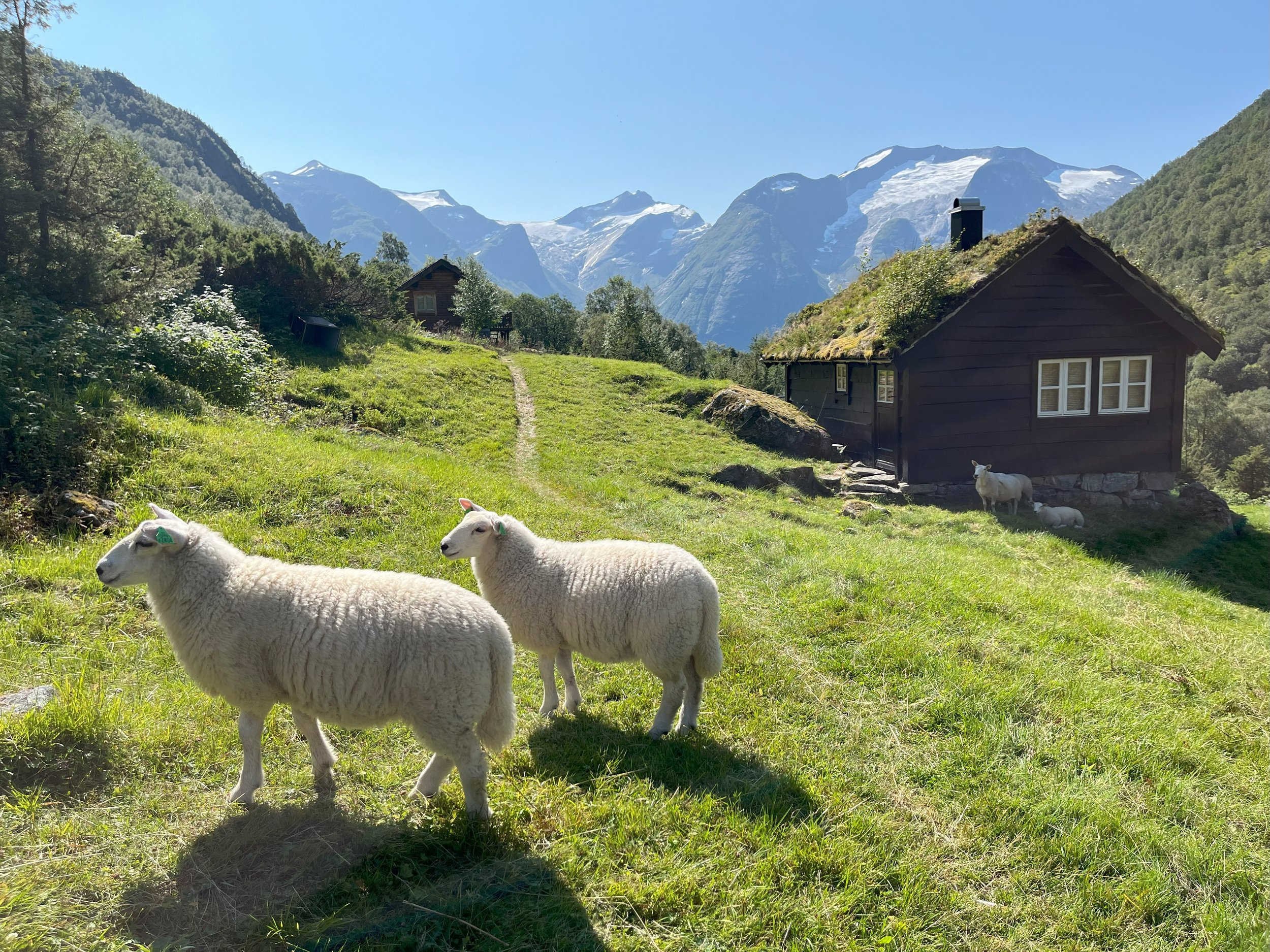
When you get to Segestad, you should take a look in the barn. Here you will find a small farm museum with old tools and boards that tell the story of this mountain farm.
The house stands like it did when the last farmer passed away in 1961. It is open to those who want to take a look.
Behind the houses at Segestad the path passes the ruins of a homestead that was destroyed by an avalanche in 1902. The houses were not rebuilt after this.
A short distance further along the path you will come to Kupegrova (a stream). During the snowmelt and after heavy rain it can be difficult to get across with dry shoes. In some winters avalanches can occur here.
From Segestad the path goes in a steady, gentle climb into the valley. In some places the path is narrow, and vegetation can make it difficult to see where to walk. Be careful!
A short distance past Kupegrova, you can see a memorial stone close to the path. This is where Oskar Tenden died in tragic accident in 1996. He slipped on the ice in the nearby stream and ended up in Glomsdøla (river).
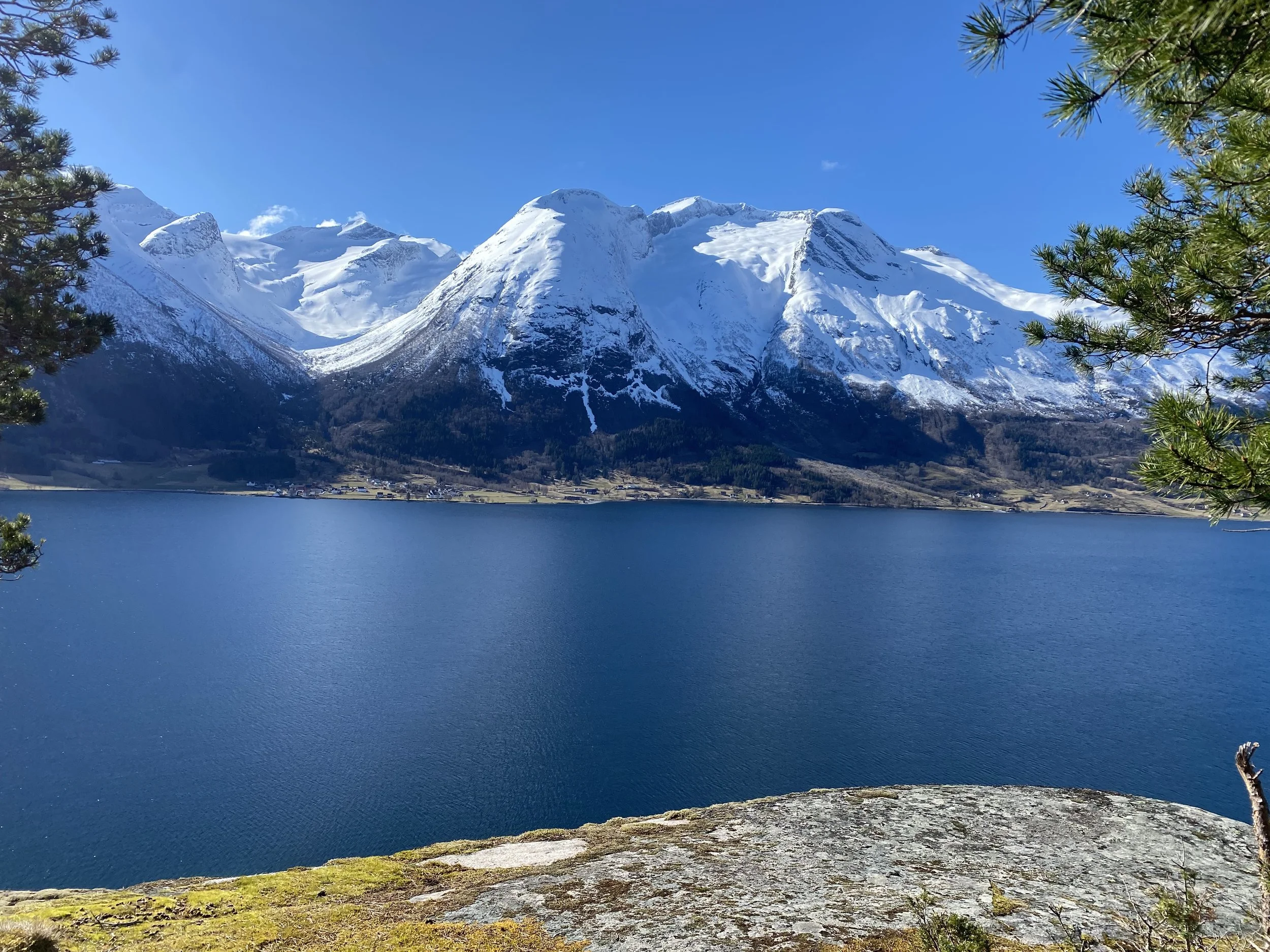
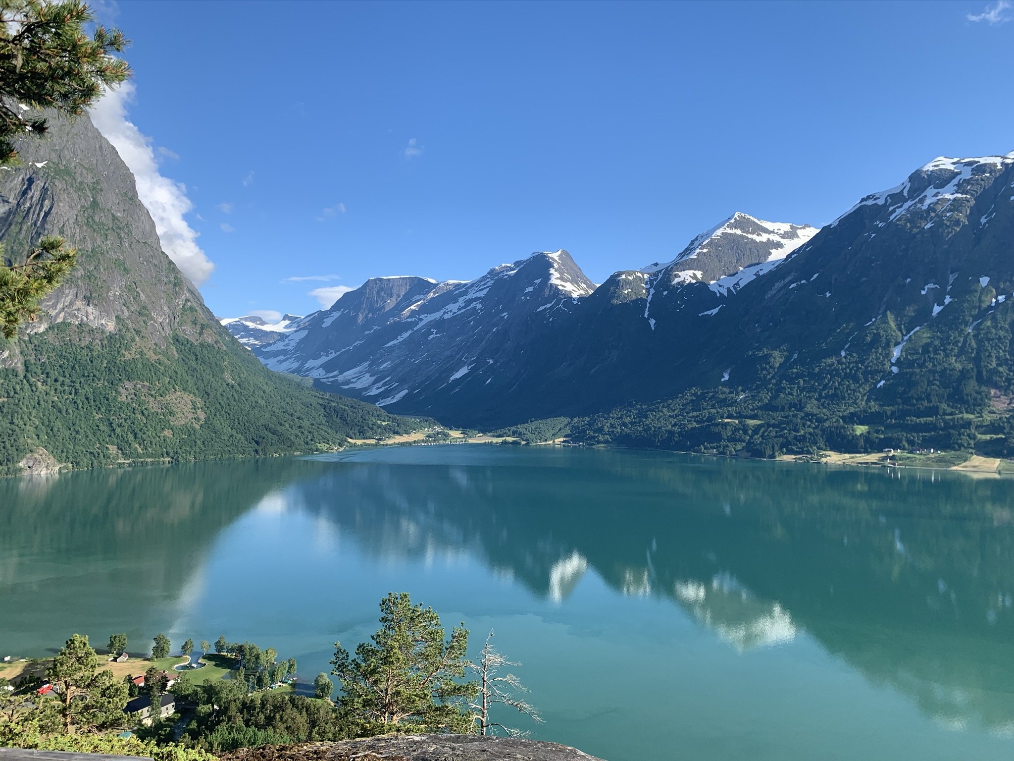
At Segestadsetra there is an open landscape, and you get a magnificent view of the majestic mountains by the Oppstrynsvatnet lake. It is nice to take a lunch break here before continuing towards Glomnessetra. There is a bench to sit on and clean water in the river.
If you look around, you will see an old dilapidated summer house built in stones between some huge rocks. This cabin belonged to one of the farms at Hjelle. You can see the remains of the Segestad summer house to the right.
The walls that you can see by a large rock closer to the river, are the remains of a barn that the two farms probably used together. It is impressive to see how well protected all the buildings have been against rockfalls and avalanches.
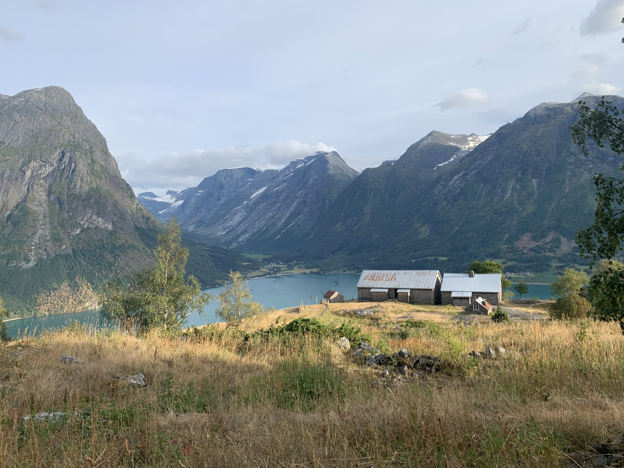
After a break at Segestadsetra you continue your hike over the bridge, and you soon come to Glomnessetra.
You will first pass an old cabin built of stone. The roof is gone and the house is falling apart. Then you will see two cabins built in more recent times.
The Glomnes summer farm had an enclosure. They cut the grass, dried it and carried it on their back to Kvilefloten (Rest plateau). From there they sent it on a zip-wire to Glomnes.
Milking at Glomnessetra and Segestadsetra ended in 1950. Prior to this, they stopped harvesting the grass here. From Glomnessetra to Kvilefloten, the path runs gently downhill. Further from Kvilefloten, the path goes steeply downhill. Here you have to be careful because there is uneven and loose ground.
When you come down to the fields, follow the path on the up-side of the fence to the car park.
Remember that there are sheep grazing. The dog must go on a leash. Show consideration and shut all the gates on your way!


The road to Glomnes with a view towards the Glomnes farm to the right and Storskredfjellet (1815 masl.) in the background.

The car park at Glomnes, please remember to pay the fee.
Hellskora
Storekvile
The houses at Segestad. Take a look at the farm exhibition in the barn and take a look in the house.

Kupegrova.
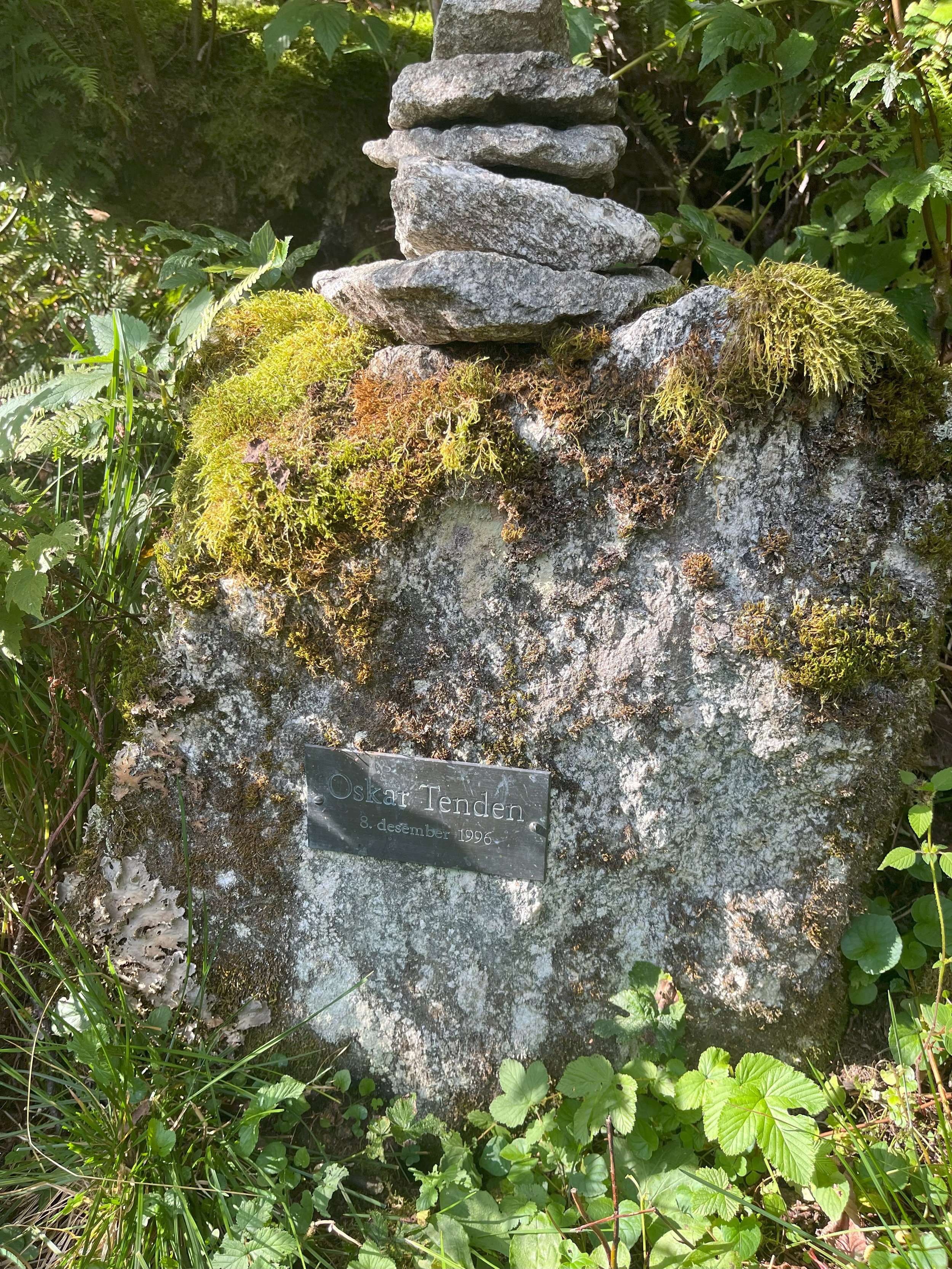
Stone in memory of Oskar Tenden who died here on December 8, 1996. He was 40 years old at the time. He slid on the ice in a nearby stream and ended up in Glomsdøla (river).

Ura. Here the path goes in rocky terrain. The path can be demand- ing in some places. Walk carefully!

A stone cabin at Segestadsetra.

Remaining of a barn at Segestadsetra (summer farm).

Bridge across Glomsdøla at Segestadsetra. There is a bench where you can take a lunch break. Clean water in the river.

A stone cabin at Glomnessetra.
Glomnessetra (summer farm).

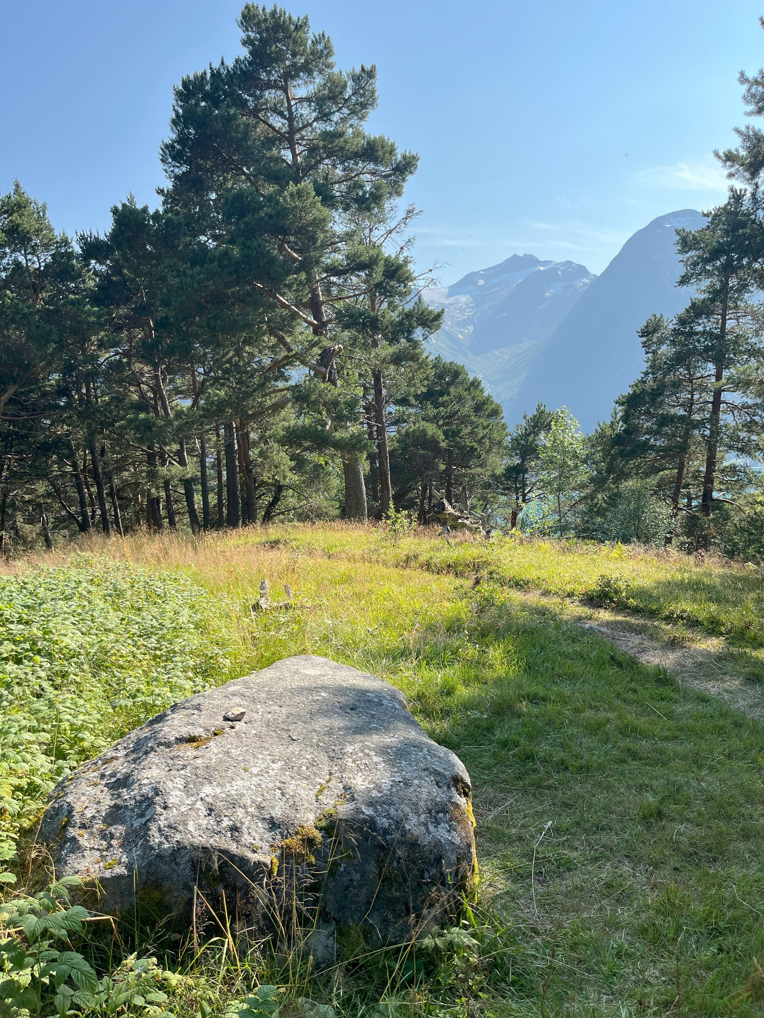
Rjømesteinen. This stone that lies by the path a short distance from Glomnessetra, was suitably large to sit on and lean the backpack with rjøme (sour cream) towards the stone.
Kvilesteinen on Kvilefloten. The stone is flat and a suitable height to sit on. The path up Glomneskleiva (from Glomnes to Kvilefloten) is steep, and it might be nice to have a rest here.

Glomneskleiva. View towards Erdalen.

Glomneskleiva. View towards Hjelle.